


Tri-Valley Offers Wealth of Hiking Opportunities
Tri-Valley Offers Wealth of Hiking Opportunities
East Bay Regional Park District (EBRPD) tends to boast about the district’s 73 parks, which total 126,809 acres and include 1,330 miles of trails and 55 miles of shoreline. Perhaps that is understandable; after all, EBRPD is the nation’s largest park district and offers an amazing diversity of outdoor experiences at locations across Alameda and Contra Costa counties.
The Tri-Valley’s parks and preserves offer hikers, cyclists, and pedestrians many opportunities to explore the region up close. Serious hikers can find challenges aplenty, while those who enjoy more urban ambles or seek accessible trails can also find trails to enjoy.
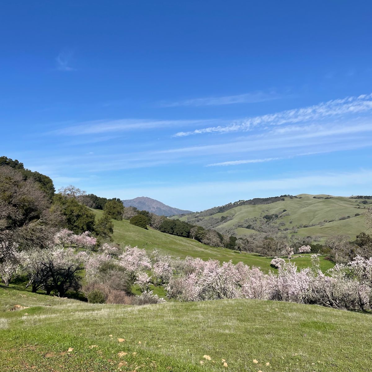
The park district is still growing when it comes to trails. In June, EBRPD held a ribbon-cutting ceremony to celebrate public access and new trails at Danville’s Sycamore Valley Open Space Regional Preserve, which opened in 2005 and totals 695 acres today.
“The trails are part of the 381-acre Magee Preserve property, which was permanently protected by Danville voters in March 2020 through the passage of Measure Y,” according to EBRPD officials. “The measure preserved 381 acres as open space while allowing development on 29 acres—at no cost to taxpayers.”
The ribbon-cutting event marked the formalization of agreements for public access to more than 3.5 miles of trails within the 381-acre Magee Preserve property that connects to Sycamore Valley Regional Open Space Preserve. Save Mount Diablo is constructing an additional 2 miles of trails on the Magee Preserve property, and the Town of Danville is constructing a 1-mile bike and pedestrian trail parallel to Diablo Road along the northern perimeter of the property. The new trails will connect to the northern ridge area of Sycamore Valley Open Space Regional Preserve.
“Expansion of the trail network at Sycamore Valley Open Space Regional Preserve was the result of successful collaboration between the East Bay Regional Park District, the Town of Danville, and Save Mount Diablo,” officials note.
Many Trails to Choose From
The broad support for preserving open space and making it accessible to the public is one of the advantages of the Tri-Valley. But those new to the region or to hiking might wonder where to hike with so many choices. Ashly Grenier, an EBRPD Supervising Naturalist who works out of the Del Valle Regional Park in Livermore, has several hiking suggestions.
Grenier recommends the East Shore Trail of the popular Del Valle Regional Park as one great place to hike. The Arroyo Road staging area in Livermore includes a no-fee parking lot and a new bathroom. The trail from Arroyo Road leads a mile uphill. While it gets quite steep towards the end of that mile, a bench at the very top rewards hikers with great views of the lake and the Tri-Valley. On a clear day, Grenier says, hikers can see parts of five other parks from that viewpoint.
This hike has other rewards as well. Visitors to the Del Valle Regional Park often see American kestrels, the smallest falcon in North America, flying overhead. A family of bald eagles also call Del Valle home. Bobcats, coyotes, and California quail may pop into view as well, depending on the time of year. About a quarter mile from the parking lot is a creek called Arroyo Valle used by different types of wildlife. Turtles and woodpeckers have been spotted there, along with signs of river otters.
Del Valle Regional Park has several trails that are hidden gems, according to Grenier. They include Sailor Camp Trail and Vallecitos Trail, which can be accessed from the Del Valle Visitor Center that is open Fridays, Saturdays, and Sundays. Grenier recommends these trails in part because the Tri-Valley tends to be dry, but there are springs and damp areas in nooks and crannies along these trails. A roughly three-mile hike with a lot of elevation gain along Sailor Camp Trail takes visitors to Rocky Ridge in the Ohlone Wilderness. Visitors need a permit to enter the Ohlone Wilderness, which is well worth getting. Especially in springtime, when Rocky Ridge is one of the best places to view wildflowers. The West Shore by the visitor center of Del Valle is another good spot to enjoy wildflowers, according to Grenier, and it is easier to access.
Other trails Grenier recommends include the Martin Canyon Creek Trail in Dublin for its partial shade, a loop trail in Livermore’s Brushy Peak Regional Preserve for its beautiful rock formations, and the Mahogany Trail in San Ramon’s Las Trampas Regional Wilderness Preserve for its fascinating microclimates. "The Mahogany Trail is a narrow, single track trail for hikers only,” Grenier notes. “It's a short trail, but it's quite steep. It's definitely an adventure. The Mahogany Trail is where you might find some wildflowers or insects that we don't see very often, like the pipevine swallowtail butterfly. The Mahogany Trail is like a little pocket of Las Trampas that's just really cool to experience."
Morgan Territory Regional Preserve outside of Livermore is also a wonderful place to walk and hike, Grenier says. The park's 5,323 acres include sandstone hills that “are adorned in spring with more than 90 species of wildflowers,” according to EBRPD officials. That includes the Diablo sunflower, or Helianthella castanea, which grows only in the foothills of Mount Diablo. "Once you get to Morgan Territory, you feel like you're in the wilderness,” notes Grenier. “You can see the Sierra Nevadas on a very clear day from Morgan Territory. It has lots of different habitats. Chaparral habitats, rock formations, oak woodlands with blue oaks, riparian creek areas where there's bay trees, and amazing wildflowers in the spring. It's a big park with lots of trails, so there's lots to explore."
Hiking from Hacienda
A variety of trails can be accessed from Hacienda or from other parts of the City of Pleasanton. The Iron Horse Trail between Pleasanton and Concord may be the best known. It follows a Southern Pacific Railroad right-of-way that was established in 1891 and abandoned in 1978. The developed 32-mile, multiuse, whole-access trail links a variety of areas, including the BART station in Hacienda, residential and commercial areas, open space and parks, regional trails, and community facilities.
This wheelchair-accessible trail is also used by pedestrians, cyclists, and equestrians. It provides direct links to three other regional trails: the Contra Costa Canal Trail, the Briones to Mt. Diablo Trail, and the Las Trampas to Mt. Diablo Trail. Regional planners intend to eventually extend the Iron Horse Regional Trail to a total of 55 miles and connect 12 cities, from Livermore in Alameda County to Suisun Bay in Contra Costa County.
The Callippe Preserve Trail is a secret treasure within the City of Pleasanton’s public parks network, according to many Pleasanton residents. The trail can be accessed by parking on the south side of the city-owned Callippe Preserve Municipal Golf Course parking lot and walking to the rear of the 18th green. The 3.75-mile loop trail is available to hikers and equestrians only, who will enjoy views of Pleasanton Ridge, Mount Diablo, the golf course, and more.
Three species of oak (coast live, valley and blue oak) are found along the trail as well as sycamore and buckeye trees, according to the City of Pleasanton. Raptors including golden eagle, red-tailed hawk, and great-horned owl may be observed. Other bird species seen are American kestrel, western meadowlark, red-shouldered hawk, California quail, scrub jay, yellow-billed magpie, red-winged blackbird and bluebird.
In short, if you love exploring the beautiful open spaces and flora and fauna of the Tri-Valley as a hiker, stroller, or cyclist, there are many trails to enjoy during every season of the year. EBRPD naturalists like Grenier lead guided programs all year round across the park district’s entire system of trails. Other educational events are also held frequently by park district specialists. One popular EBRPD program is the annual free Trails Challenge, which provides 20 designated trails ranging from easy to moderate and challenging, including a number of fully accessible trails that have been evaluated and identified as usable by persons with mobility limitations.
Fairly flat, short, and accessible trails and picnic spots are plentiful throughout the park district as well as Hacienda and nearby. The Pleasanton Ridge Regional Park, for example, is a 9,090-acre treat located on the oak-covered ridge overlooking Pleasanton and the Livermore Valley from the west. There are many wonderful places to experience the outdoors and all it has to offer. As Grenier adds, "you don't have to go on a long hike to feel reconnected to nature."
For more information about the East Bay Regional Park District and individual parks and preserves, please visit www.ebparks.org.
For more information about the East Bay Regional Park District’s Trails Challenge, please visit www.ebparks.org/activities/trailschallenge/default.htm.
For more information about the Iron Horse Trail, please visit https://www.ebparks.org/trails/interpark/iron-horse. For more information about the Callippe Preserve Trail, please visit www.playcallippe.com/environment/callippe-hiking-equestrian-trails.
For more information about Hacienda’s recreation opportunities, please visit www.hacienda.org/amenities-employees-residents/recreation.